Stagnant.
Weak, unsure.
After weeks of being stuck in stasis, paying an expensive daily rate in a holiday park in Queenstown, we were finally ready to rejoin the trail. In a way, it feels a bit like this very blog – it’s been about three years since I’ve written anything here and I’m feeling a little trepidatious. But what a glorious place to return to trail form: the magnificent Motatapu Track, connecting Queenstown and Wanaka. I hope the beautiful pictures from this section might make up for my poor writing form.
But first, we had to get to the start. Our first night out of the van was slated to be tenting in Arrowtown, a small mining town turned tourist paradise. And I admit: we cheated. We actually drove to the holiday park in Arrowtown, set up our tent, and left a majority of our gear there before parking the van back in our friend’s yard in Queenstown. We still needed to walk back to our tent, but this felt like the perfect way to get back into it! It allowed us an easy day with minimal stuff, at the expense of a later start.

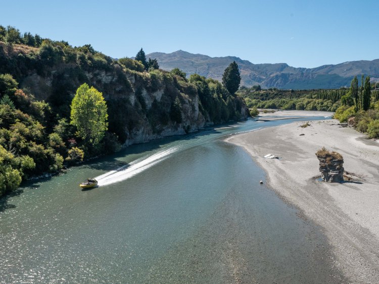
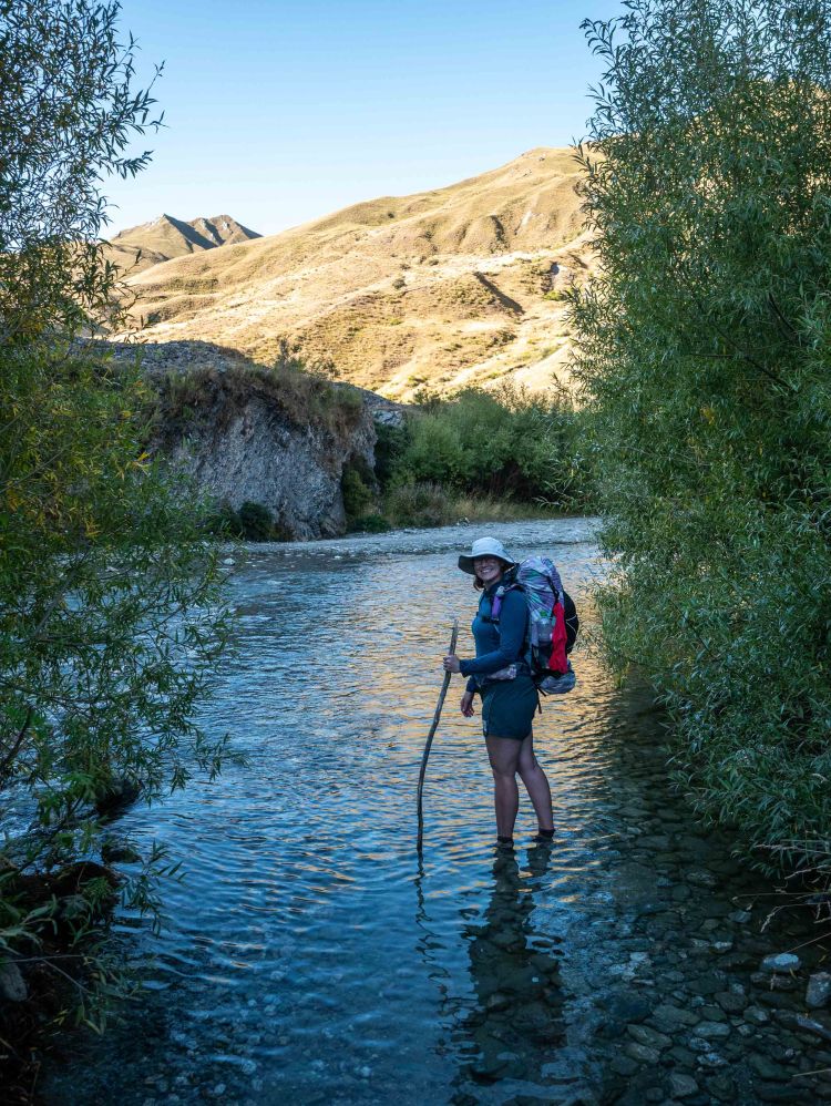
Nothing goes exactly as planned, however. After parking the van, as we trotted up the trail along the bank of the Shotover river, we discovered that it had been washed out – severely. A steep cliff lined by private land kept us from going up and around, so our only option was to backtrack and ford the river.

The flow of the river wasn’t terribly strong in the late Summer season and it wasn’t too deep, luckily. Wading in, we felt happy with our decision, and our capability. But as we were knee-deep in the middle, we heard a familiar thrum in the distance: Jet boat. A popular tourist activity, surface-skimming jet boats zoom up and down many rivers across New Zealand, and the Shotover is no exception. Our confidence soured and we tried our best to hurry across. Luckily we were fast enough, though we were still in the river up to our calves when it zoomed by. I wish I knew what the passengers thought of us.
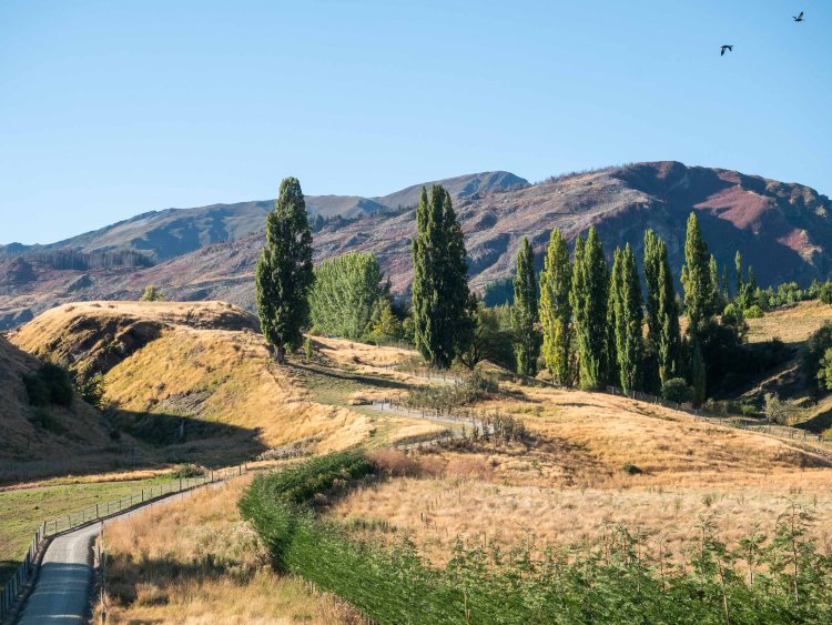
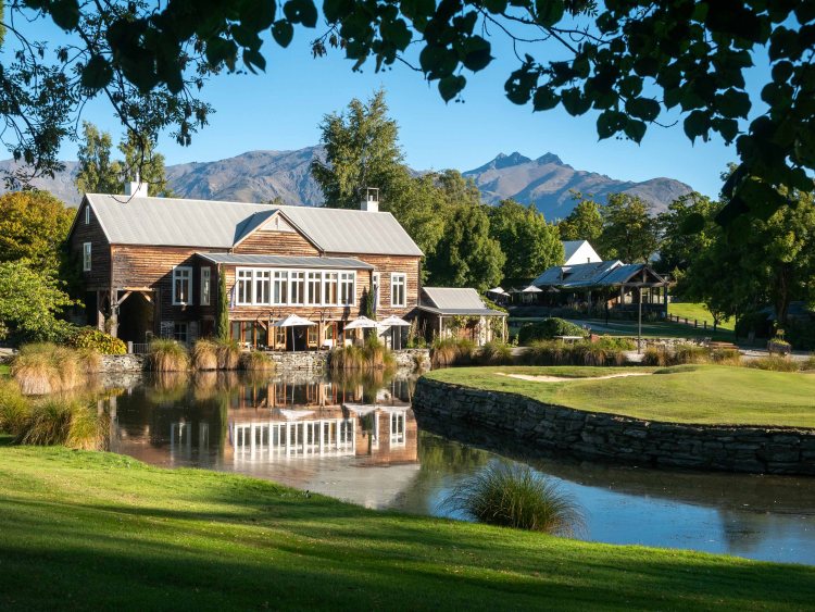
The day was hot, but the trail was well groomed and relatively flat. Queenstown is the premiere tourist destination in New Zealand, and it shows – Vineyards, golf clubs, and gated neighborhoods – and the path walked us past a beautiful selection of these.

Though we had little weight for this hike, it was longer than we had hiked in many weeks and our pre-prepared tent was a welcome sight. We took a break before walking into Arrowtown for some Indian food. We got a chance to see the Hurricanes, one of New Zealand’s Super Rugby teams, practice in a nearby field.


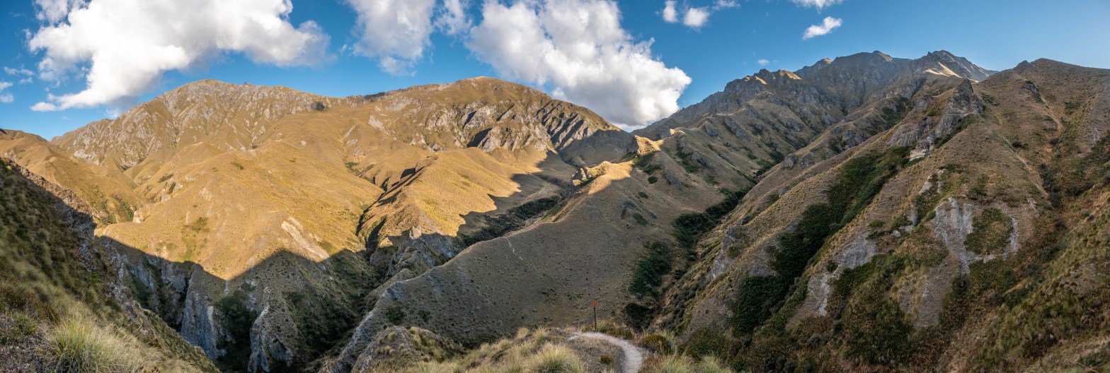
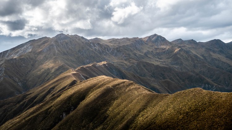
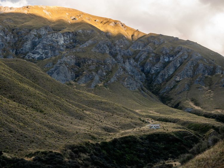
The true first day of the Motatapu Track started on the next day. From Arrowtown, you ascend 684m up the flanks of Mt Coronet through the arid terrain common in Otago: dense forests of beech trees nestled into the small valleys, with golden fields of waist-high tussocks presiding over the ridges and tops. We reached the saddle of the aptly named Big Hill and stopped to marvel at the tapestry of other big hills, jutting up as far as we could see.

After a brief break (note: it was not brief), we donned our packs and started our descent. Big hill is a popular hiking trail out of Arrowtown, but few continue down the other side; the trail was not well maintained, and we were reminded that we were now on Te Araroa truly.

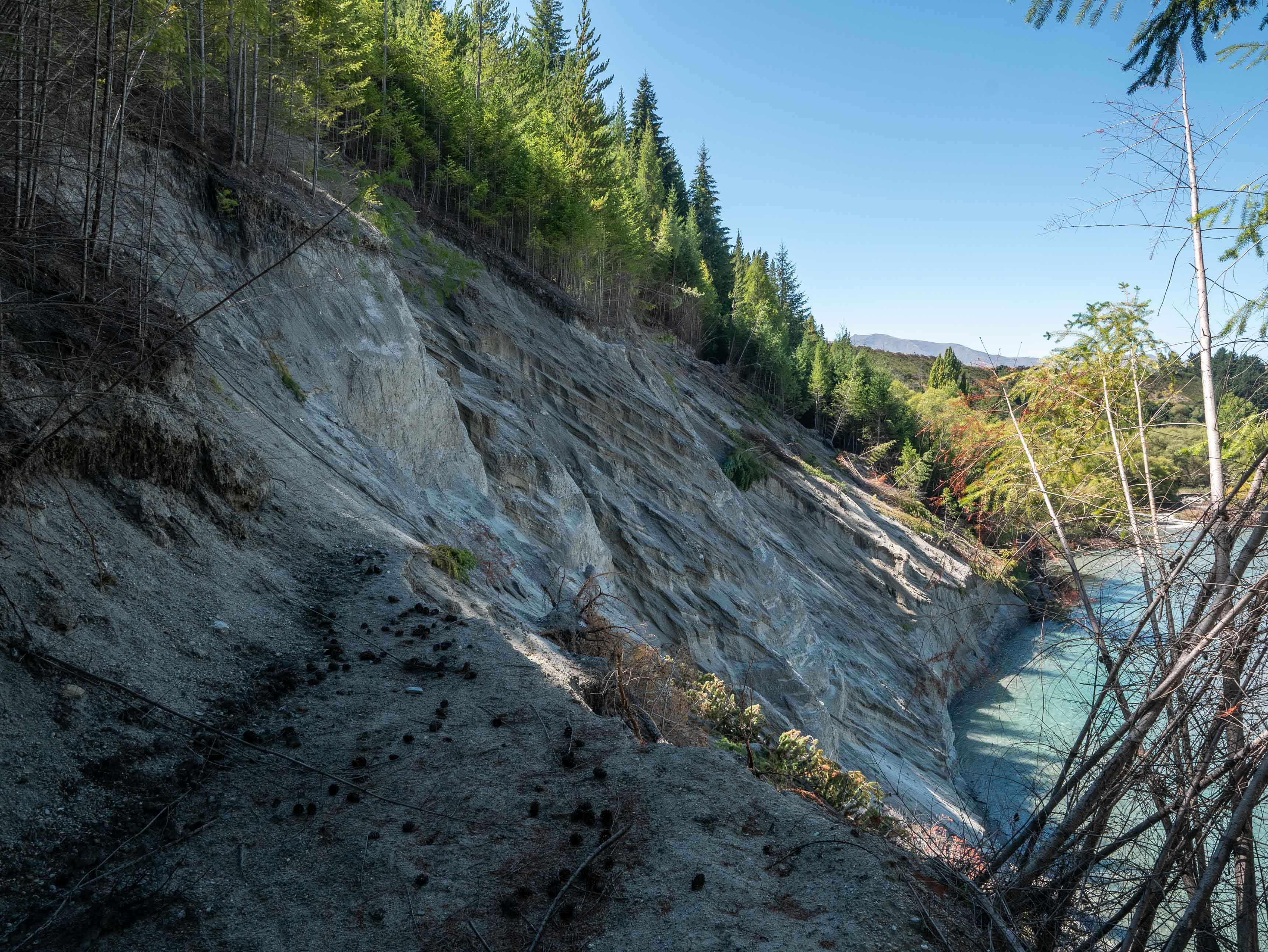
After a few slips and cuts, we reached the bottom of the valley and joined a 4WD road. We crossed the Arrow river a handful of times as we worked up the valley until we reached a large, flat basin. Gold miners had set up homes and businesses here in the heyday of gold mining, but now they only remained as historical sites.

After 12km horizontally and 800m vertically, we ended our first day back on trail at the Macetown campsite under a clear sky. We elected to set up our tent with the door open, allowing us to watch the stars overnight.

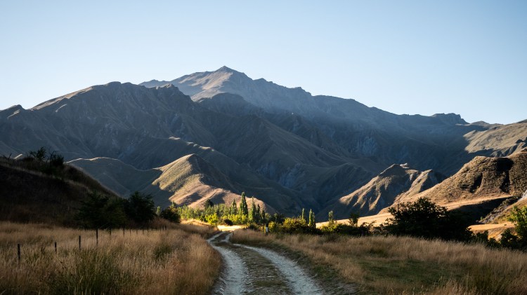
Late February is closing in on Fall in New Zealand, and we felt the chill in the air the next morning. Early on, we were presented with a decision: continue slogging upstream along the Arrow River, or take the high route trail. Southbound hikers will often opt to take the river, as it is downhill/downstream; we decided to take the high route.

In hindsight, the high-route trail was one of the most treacherous sections of the entire trail we did. Though it had clear signs of being maintained, often the cut-down tussocks were strewn across the steep trail, causing slippery straw heading downhill. Matagouri, a native plant that evolved 2-inch long spikes to fend of the now extinct Moa, has taken over many hillsides, requiring the trail to boldly go directly through thickets of it. The terrain is steep, so there were some large, precarious steps in no-fall zones (as you would slip 10 feet down into a matagouri bush). All up it was a pretty slow-going section, but I’m not sure if it was worse than walking upstream.

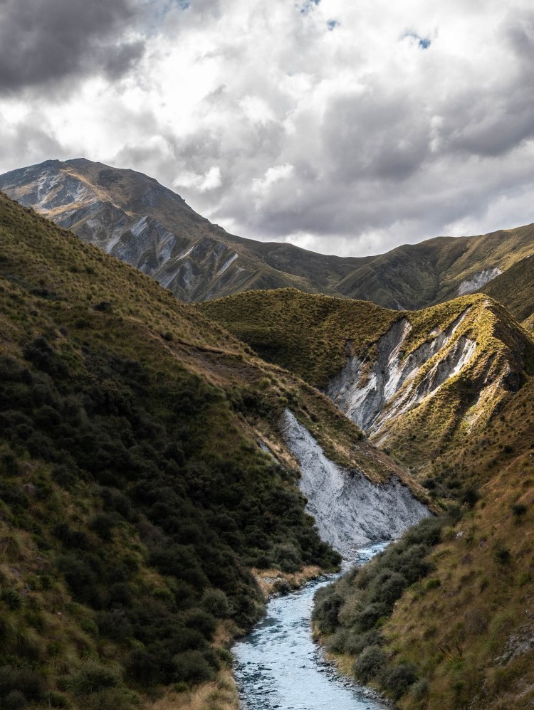
Soon enough the trail headed up from the river to gain the ridge. Though it was steep, the trail was better tramped out and the wind was finally able to start cooling us off. The beating sun from the day before had given way to high clouds, and we were thankful for it; still, it was hot work.

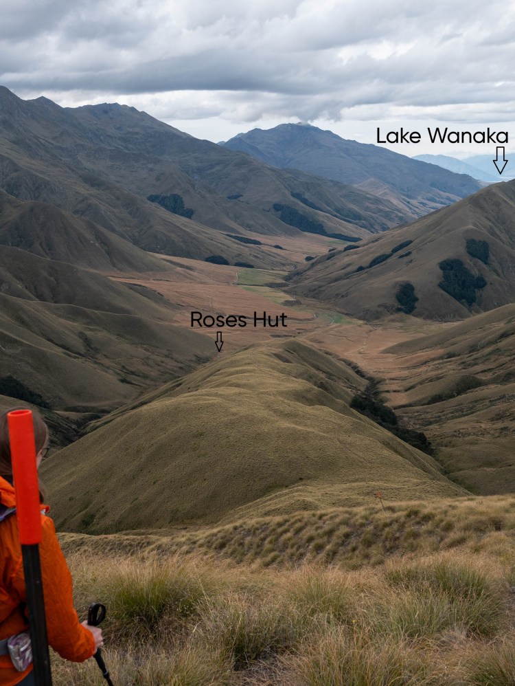
The ridgeline brought us to our second major saddle of the section: Roses Saddle. Sitting at about 1200m elevation, the wind whipped over the saddle and we chose not to spend too much time there. The view couldn’t be beat, however: we could see the backside of Mt. Coronet behind us, and we could see the tiniest sliver of Lake Wanaka far in the distance ahead. Also, it was all downhill from here to our first hut of this section!

After a long 10km day, we shared Roses hut with one SOBO (southbound) TA hiker. The hut was modern, but the location wasn’t terribly remarkable.


The next day started with rain. Not a lot of rain, just a little sprinkle, but it set the tone of the day a little bit. Hushed and clad in rain jackets, we started tromping up the next hill. The Motatapu track is touted as being a quad-buster, with more than 3000m of elevation gain overall, and our legs were certainly feeling the atrophy after our break.


The rain abated as the sun came up, but the hills – unfortunately – remained. We followed a ridge for the first half of the day before ducking down into a small beech forest before gaining another ridge before ducking down into a small beech forest before gaining a ridge….you get the idea. Sunscreen was reapplied, music was put in our headphones, and legs were massaged as we went.

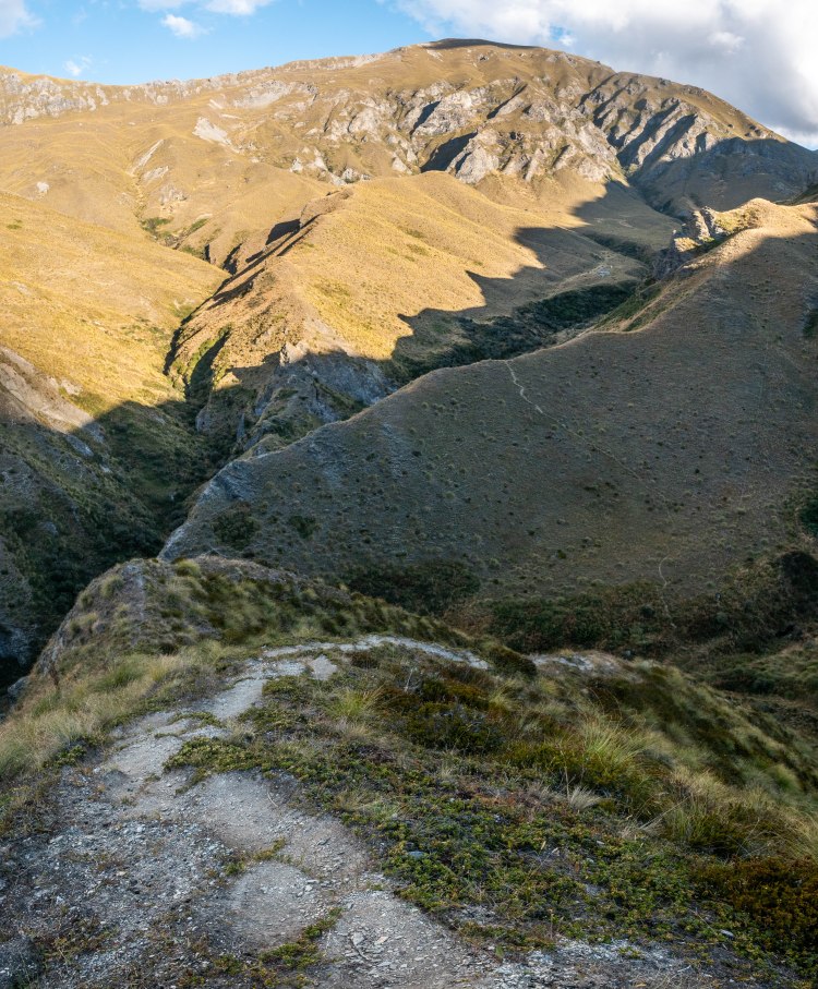
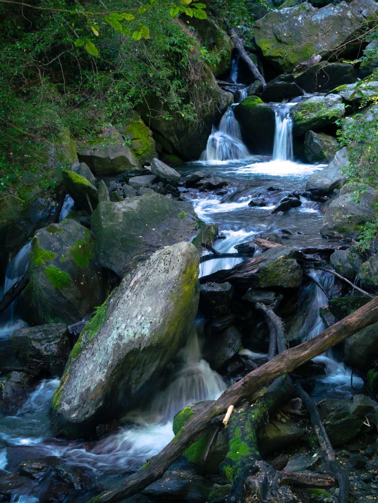
The trail along this section was also treacherous at times, with the same slippery tussock problem present, as well as some steep no-fall sections. Near the end of the day, as we descended down into a canyon cut out by a small stream, footsteps had been seemingly kicked into the hillside allowing for a ladder-like descent.


Though the day ended with a middling 10km, it came with 1100 meters of ascent and descent, the largest of the trail so far. Our legs ached and we arrived at a snail’s pace, but the Highland Creek hut welcomed us in glorious fashion. The hut itself is one large room, but that wasn’t what impressed us. As we walked up to it, I made the comment: “This is where dragons and giants would live.” The hut felt tiny in a landscape of vast rock, hill, and cloud, and I felt blessed to be able to experience it.
It just so happened to be our wedding anniversary that night, and we were fortunate enough to have the hut to ourselves to reminisce about the crazy last two years we had had. Someone before had left the last half of a candle in the candle holder, so we had just enough left for a candlelit dinner. We celebrated with our favorite trail meal: peanut butter sriracha ramen! We even ate extra fingers off our kit-kat bars. Though the wails of the possums in the creek basin nearby were a little off-putting, it will be a hard anniversary to beat.


We chose to take it easy the next day. We had a high saddle to mantle, but there was another hut just on the other side, 6km away. It was a misty morning, so we spent it watching the fog burn away before ambling along the trail. As before, it was steep. But we allowed ourselves all the time we needed. The views of the surrounding peaks were stunning, and lunch at the saddle was glorious.


We arrived at the Iris Burn hut early in the afternoon, and we shared it with a couple who were hiking the Motatapu SOBO. The husband had brought his Nintendo Switch along, and I felt a pang of envy for a moment. Then the moment passed as I saw how big and heavy his pack was. I was able to get one of my best milky way shots here:

Fun fact: the Motatapu station farm (the large plot of farmed land all around here) was once purchased by Shania Twain, but the DOC had a condition that a public access track had to be built through it – so, the Motatapu track is colloquially known as the ‘Twain track’ for a bit of fun.
The last three huts (Roses hut, Highlands Creek hut, Iris Burn hut) were all created as a part of this public-access track, and as such, are nearly identical. I believe they were all created in the 2010s, so they are very nice modern huts.

Our legs were finally able to catch a break on the fifth day. Going from the Iris Burn hut out to Lake Wanaka, where we would be staying at a campground, was almost entirely downhill.

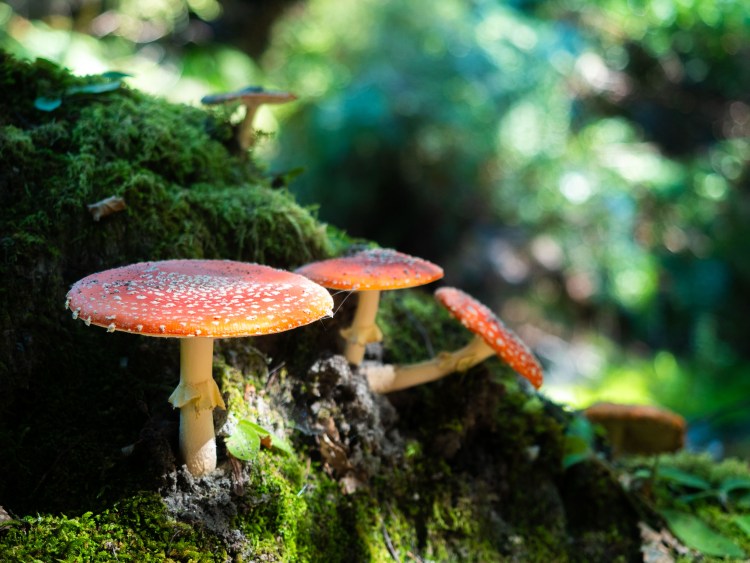
The trail took us through a gorgeous forest section that really showed the change of the season into fall, as there were bright red mushrooms popping up everywhere.
We joined a gravel road about halfway through the day, and hiked the rest of the way in the beating sun inhaling the dust from the occasional car passing.
Once we arrived at the Glendhu bay camp, we took the opportunity to take some showers and get some treats at the camp store. We soaked our feet in the lake and enjoyed the view of Mt Aspiring. The hardest part of the section was done, and the following day was just a simple walk into Wanaka along the lake.

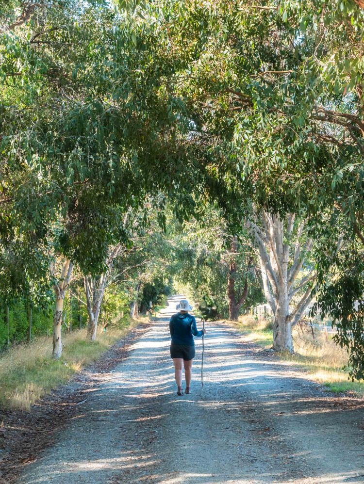
Though it was just as long as any of the other sections at 12km, the walk along the lake into our Holiday park in Wanaka was a very relaxing time. Our packs were light since we had eaten most of our food, the track undulated up and down gently, and we eventually recognized the point where we had run along a few months before. All up, a perfect end to a physically demanding track.

I will wrap up here, the next section will combine our time in Wanaka and Hawea nicely. This turned out a little more long-form than I planned, but it was one of the more striking sections that we both really enjoyed. Thanks for reading, I hope you enjoyed!
–Cameron
