
Date of Adventure: 27-30 March 2021
It didn’t happen all at once. It happened slowly, as the storm continued on our head. First, the faint blurriness, then a noticeable fog in every picture. As the rain worsened, photos became indiscernibly blurry. At last, attempting to take a picture of one final waterfall, the camera gave out and the screen stayed black.
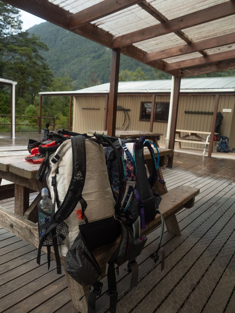
Having just finished the Kepler Track, Kadi and I found a quiet park to spread out our gear to dry. We had strewn it all out onto the grass in front of the van, and hoped the cars driving by didn’t judge us too harshly.
Contemplating our next destination, we decided we had time to travel south to Stewart Island before our scheduled Routeburn Track in Queenstown. Therefore, we drove to Manapouri (Just south of Te Anau) to spend the night before our travel south the next day.

Stewart Island is home to the Rakiura Track, one of the Great Walks, so we got on the booking website to see if there were any chance openings we could grab. As we logged in, Kadi suggested we take a look to see if the Milford Track (which is always fully booked within hours of the season opening) had any vacancies.
By luck, there were 3 vacancies…tomorrow!
That would give us less than 18 hours until we would start the track! We scrambled to figure out other details–boat transport to the start/from the end of the track, bus shuttles from Milford Sound, and food for 4 days. We checked the weather…90% chance of rain everyday for the next week!
The Milford Track is a world class trail that I wanted Kadi to experience, but would it be miserable in the rain? We had just tramped for 4 days after not hiking for months–would our bodies be able to handle another strenuous trek?
After deliberating on these for a while, Kadi and I decided to book the rainy Milford Track for the next day. I mean, how bad could it be? We had good rain gear! As such, we spent the next couple hours returning our equipment to the bags it had just escaped, and planning out and preparing our meals. Adventure!
The next day opened with a sunny morning, giving us hope that the weather service might be wrong about the following 4 days. We drove back north to Te Anau and parked the van at the DOC visitor center, where we met a few people who would be walking the track with us. A bus picked us up there, then dropped us off at a dock in the middle of Lake Te Anau (ok, along the shore, sheesh).

From the dock, we still had an hour ferry ride to the start of the track. By now, tumultuous clouds had started forming over the mountains to the west, and we knew that our earlier wishes were just that: wishes.
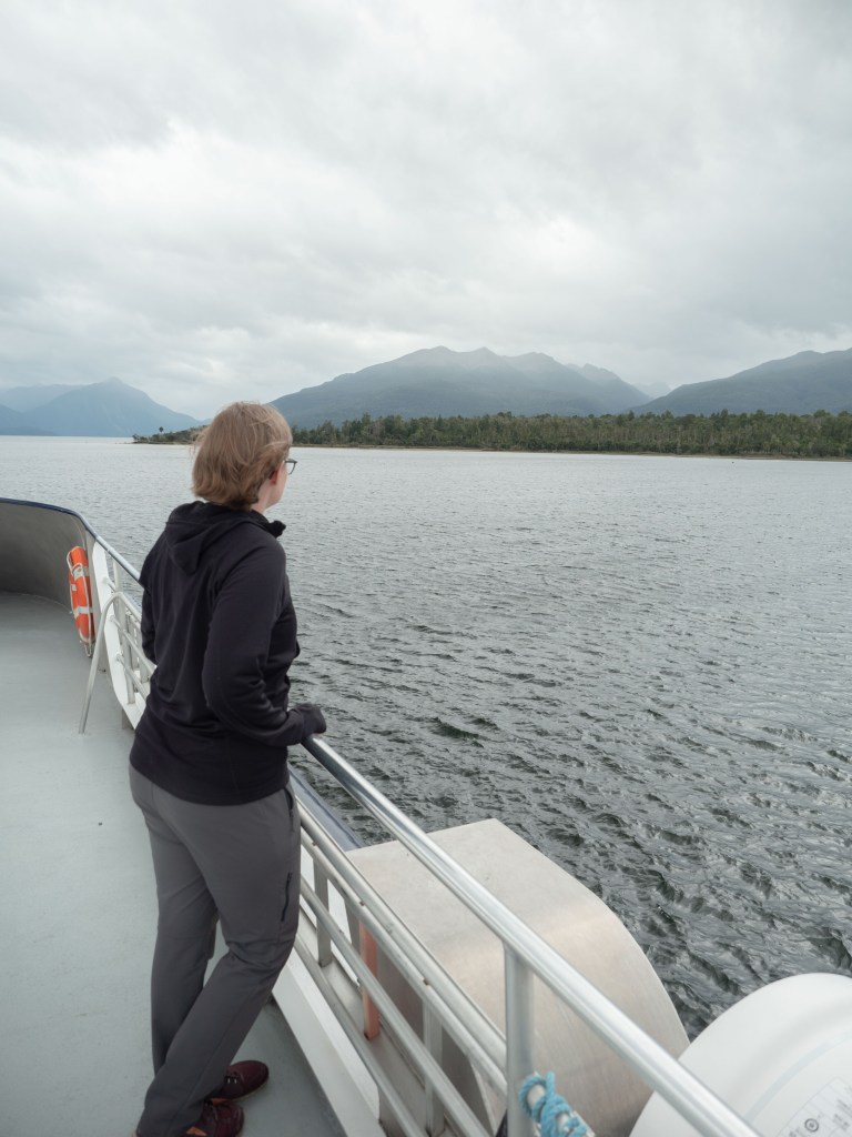
The Milford Track can be done self-supported, where you bring all you need for yourself, or as a guided walk, where all the food and supplies are brought along for you (sometimes by helicopter!). This boat serviced both types, so it was packed full!


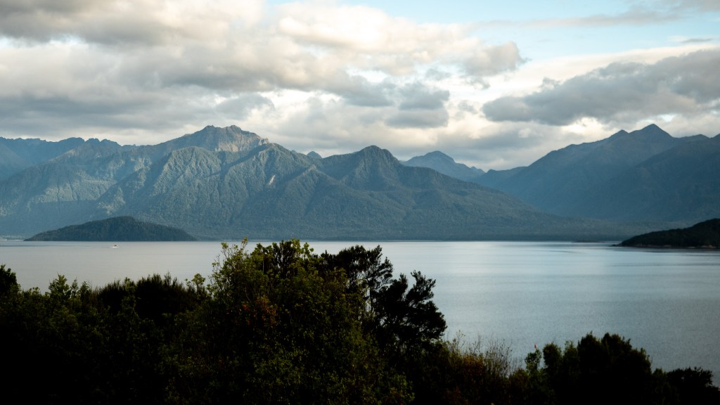
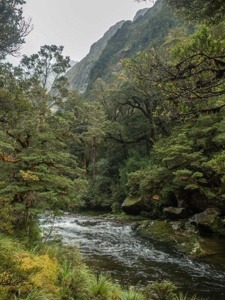
As we approached the northern tip of Lake Te Anau, we could see the mouth of the Clinton River open up to us, an invitation to follow it up to it’s headwaters.

As you step off the boat, your next job is to immerse your feet into a yellow tub full of sudsy water. This is to kill didymo, an invasive algae that is slowly making it’s way through New Zealand’s freshwater basins. At the time of writing, the Clinton river is still clear, as long as all walkers do their part!

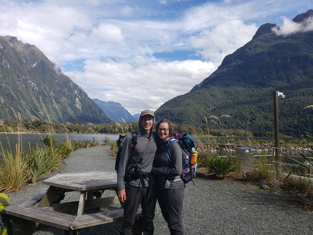
Finally, we took our first steps on the Milford track! We stood in the short line that formed in front of the start sign, taking turns handling strangers’ phones and cameras before we got our picture in front of it.
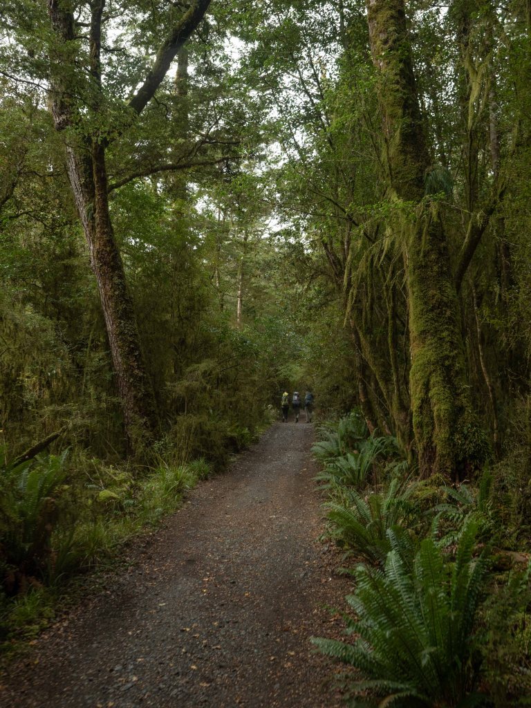
Some people headed out quickly, and some meandered down the well formed trail. Kadi and I were on the slow side, as I stopped for pictures every twenty meters.
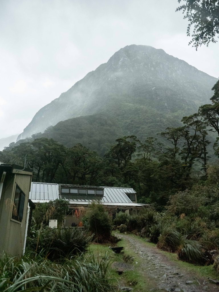
Before long, the first hut appeared in a large clearing. It was a large hut for supported walkers. A few of our boat mates headed in, but most of us continued onwards. The dreaded rain had started in earnest, and a handful of us found refuge under a large pine to pull out our rain gear.
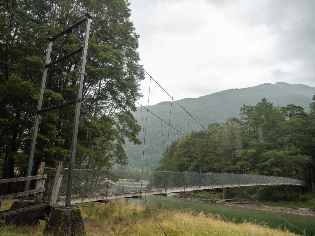
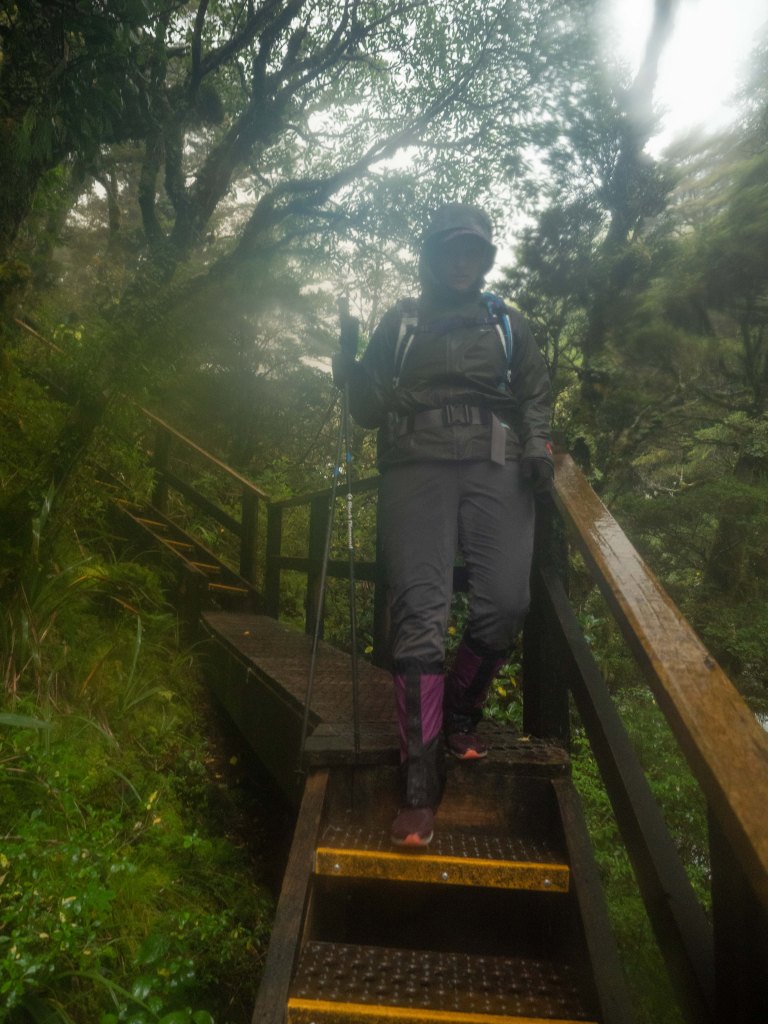
New Zealand’s tramps are well known for their swing bridges: metal suspension bridges that go over the myriads of rivers that course through the backcountry.
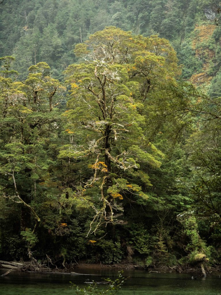
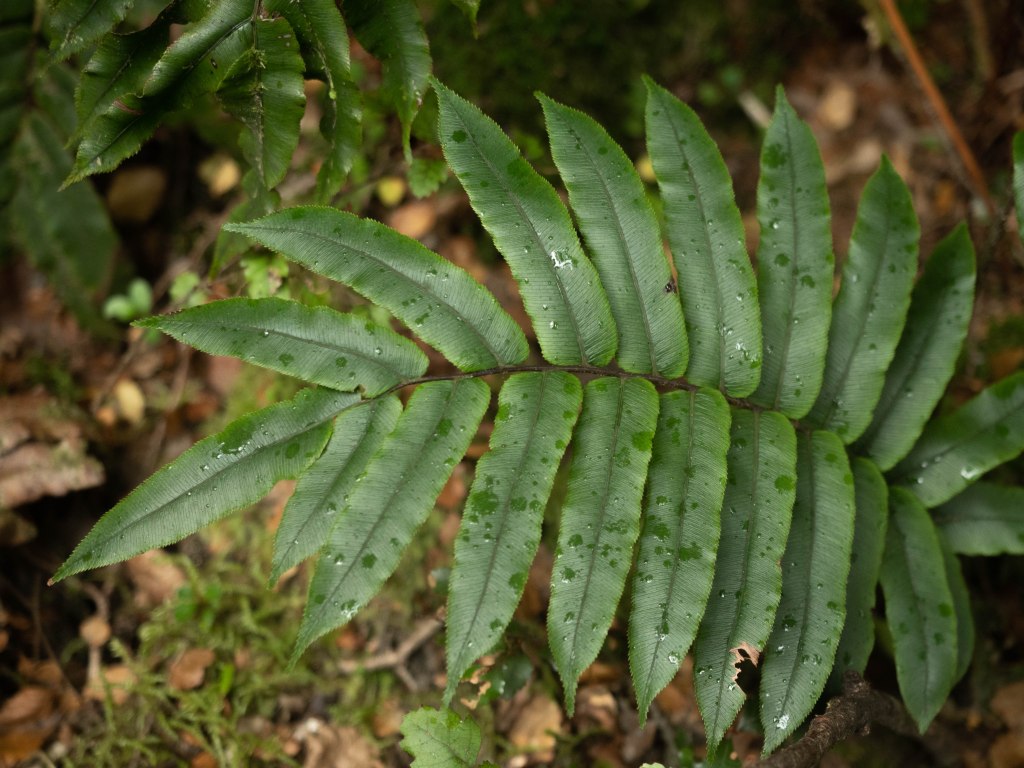
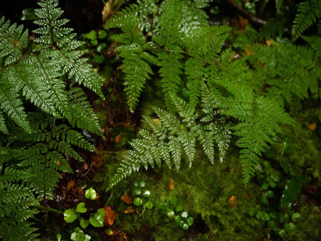
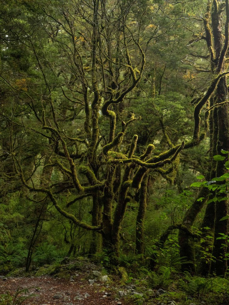
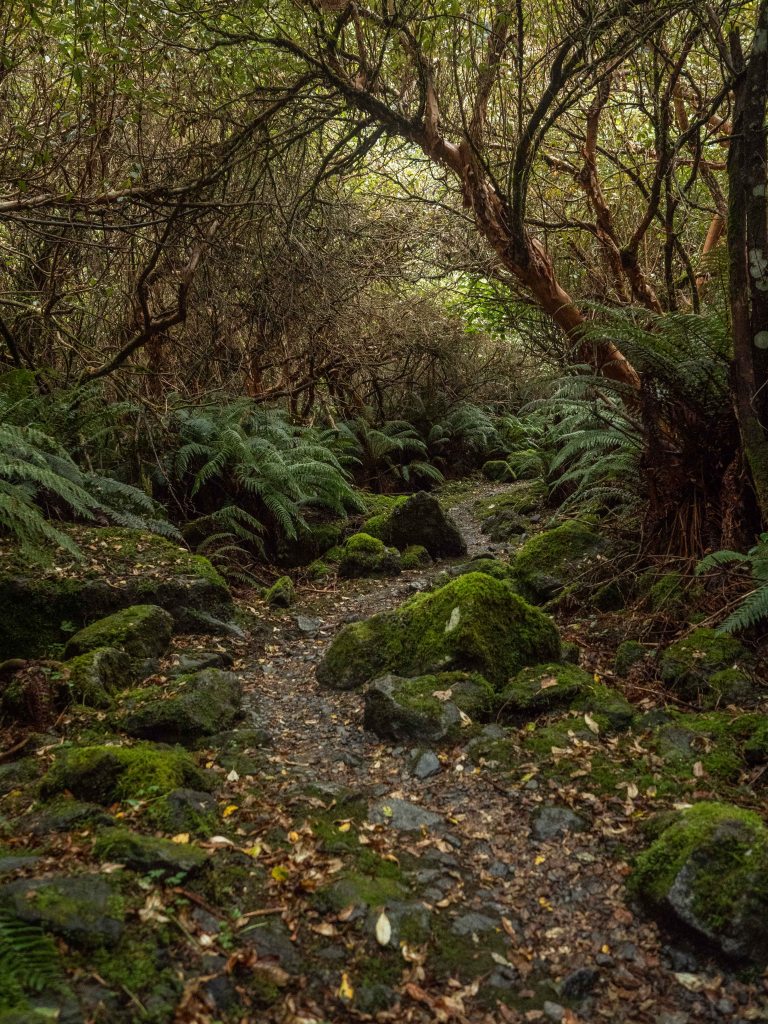
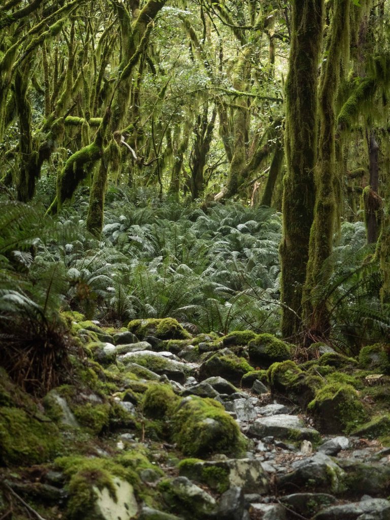
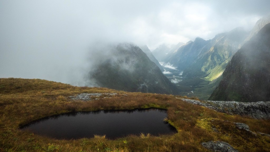
The wide valley floor we walked through was so incredibly lush! Even though we were on the same lake as the Kepler, the vegetation and underbrush were drastically different.
I was excited to find some familiar photogenic lookouts from the last time I had walked this in 2015; however, as we came up to them we discovered that the river had widened, washing out the trail, diverting it inland.


Though I was sad I couldn’t relive those moments, it was a good reminder that this was a new hike, and this time I got to share it with my wife. I was reminded of the saying: “No man ever steps in the same river twice, for it’s not the same river and he’s not the same man.” -(Heraclitus? According to Google)
Soon, the first optional side hike forked off to the left. We decided we wanted to take every side path possible, so we took the short loop trail to see the unique marshland it went through!


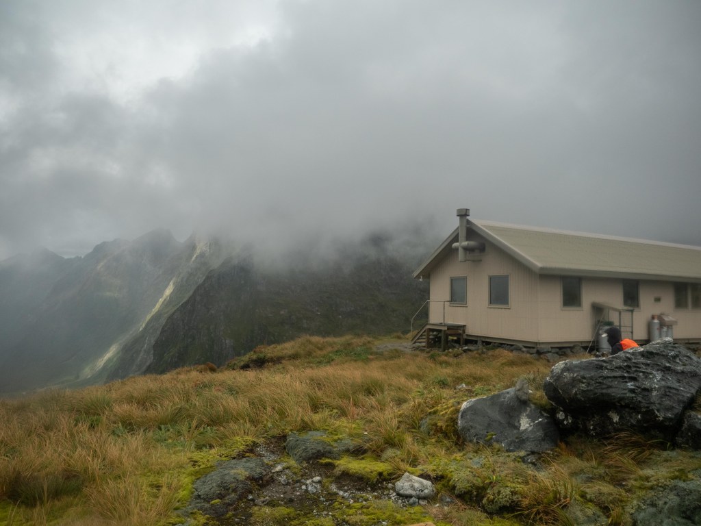
The first hut was not too much farther once we regained the main trail. It was bustling with activity, as we were some of the last ones to arrive.
We checked ourselves in and found our bunks, then went to the kitchen to meet the trampers we would be sharing the trail with.
Even though we had only been in the country for a few weeks, we saw two familiar faces! Tom and Murray had just done the Kepler track with us, and we all gave each other loud greetings in the din of the common area.
As the merriment continued, a booming baritone suddenly cut through the noise. Ross, the hut warden, greeted us all in a Maori welcome. He was tall, walked with a long tree branch for balance, had one lazy eye, and a deep voice that resonated in your bones. He invited us all to go on a nature walk with him, and Kadi and I definitely wanted to tag along!

As the small group walked through the damp forest, Ross talked and joked with a few people. His intimidating aura diminished, but his impressive figure did not, as he lead us down the path, telling us trivia and curiosities about the forest around us.
He told us to keep our eyes open for Whio -rare New Zealand river ducks- as we approached the river.

As dusk took the light away, our little group got to see a small collection of Whio in the middle of the river! Ross told us about the trapping program meant to keep invasive predators away from these beautiful waterfowl as we watched them talk and play in the eddies. What fun!
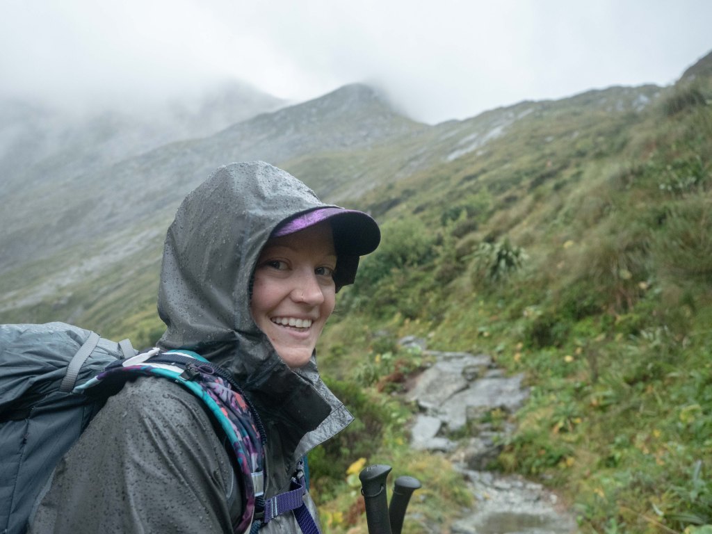
The next morning was damp and foggy, with a little rain sprinkled in here and there. Kadi and I made our breakfast quickly and headed down the trail, since Ross had warned of late afternoon gales passing through.

We found an old phone box Ross had told us about, from when there was a telephone line that ran the length of the trail.

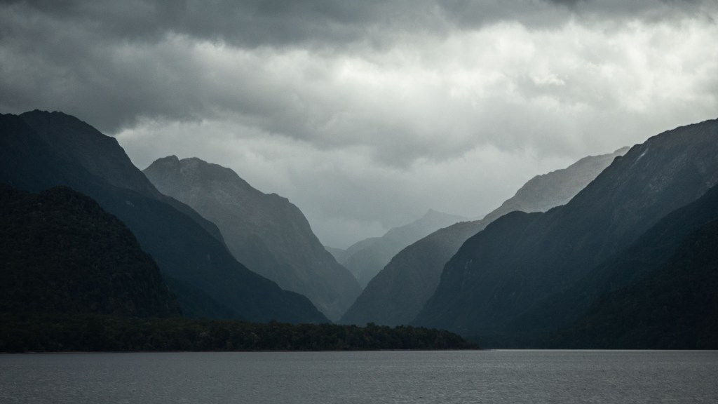
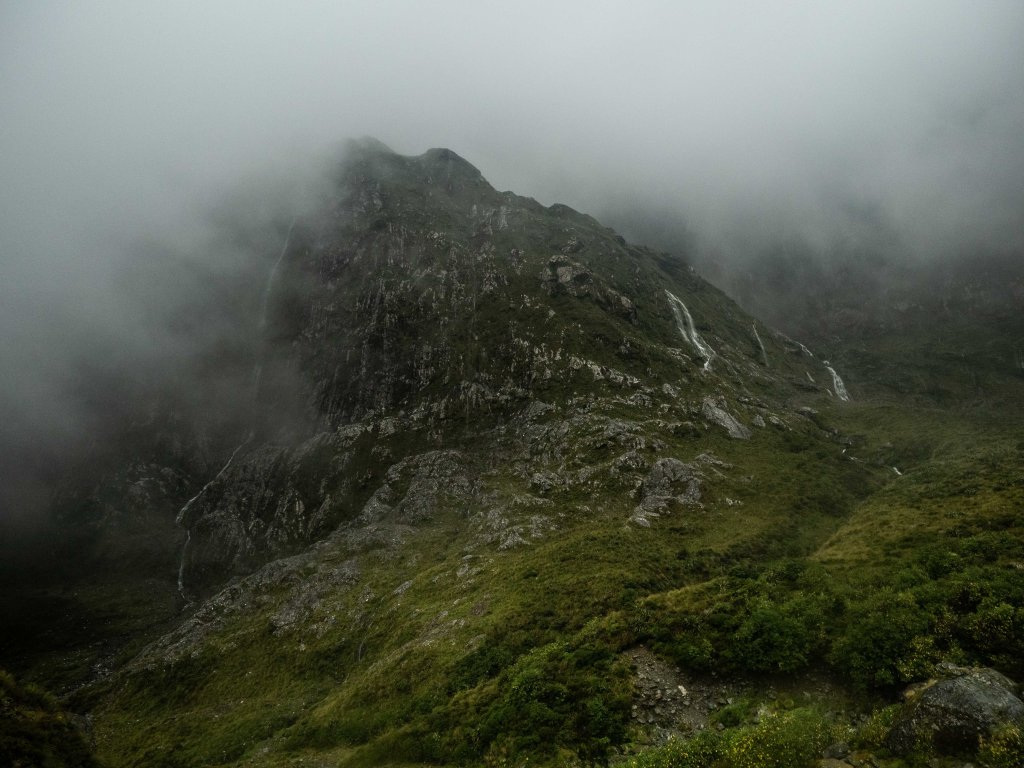
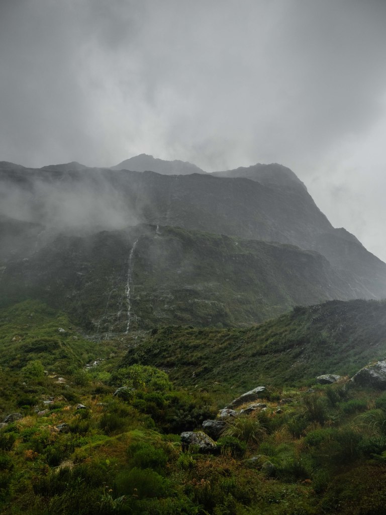
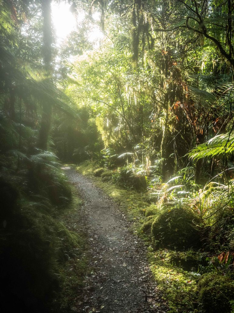
The path itself marched along the Clinton river valley, but we could tell that the adjacent mountains were squeezing in closer, and the beech trees started getting shorter as we gained elevation.

Though we could see glimpses of the dramatic cliff faces around us through the dense forest, the true size of these mountains was briefly revealed when the path meandered into fern meadows or through waterlogged swamps.


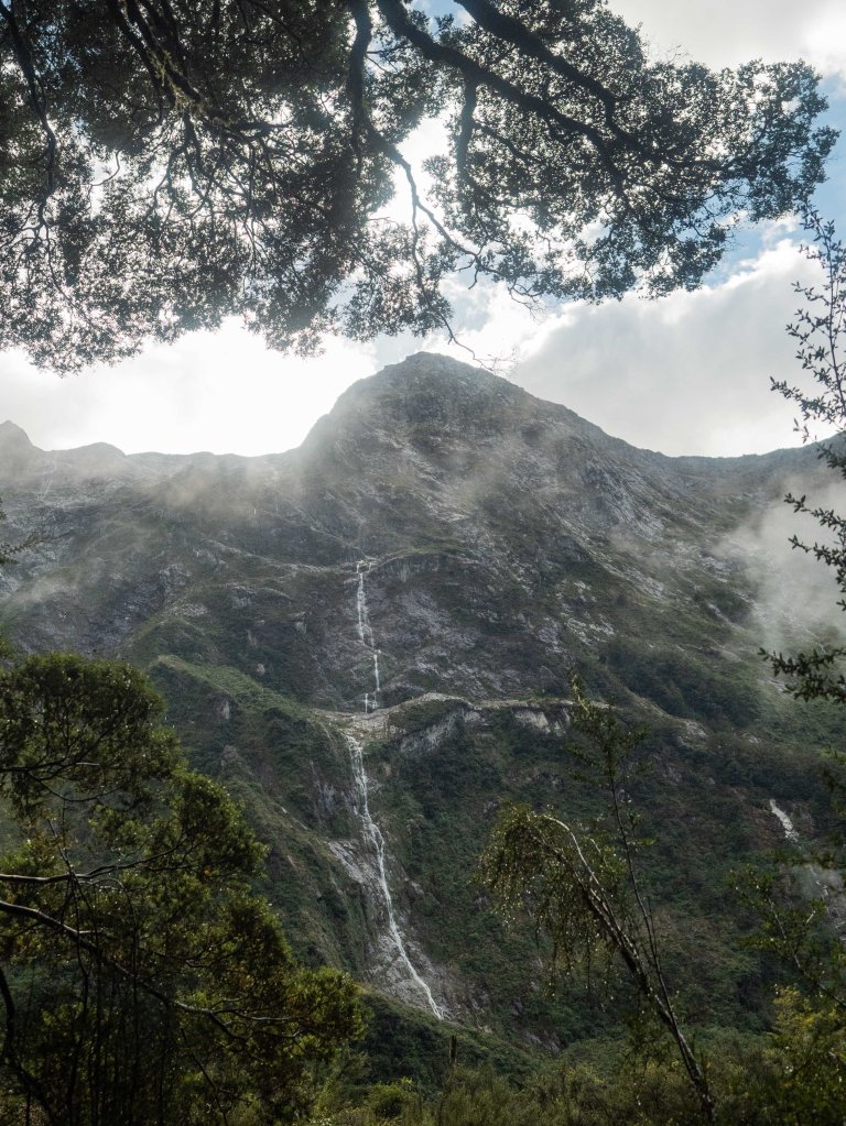
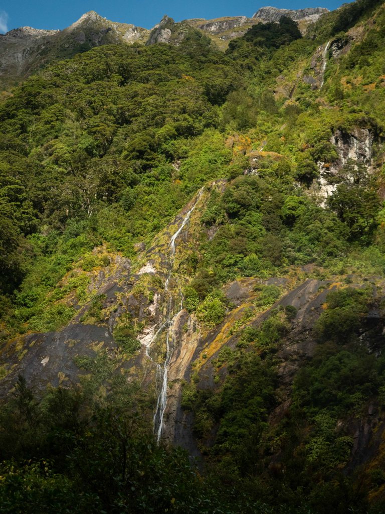
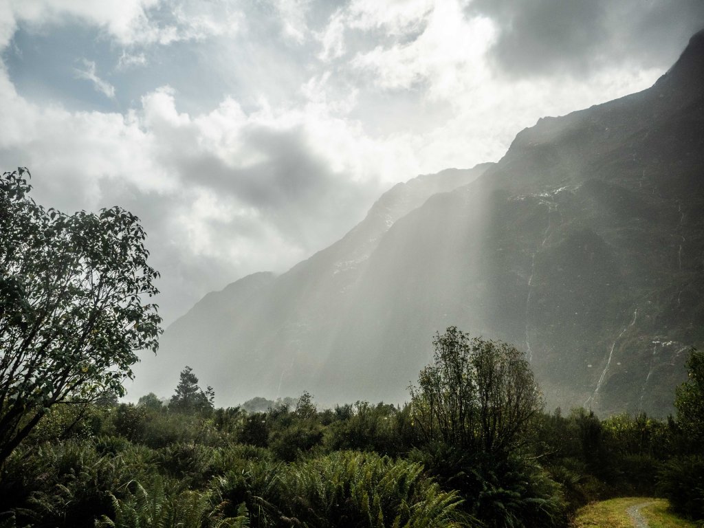
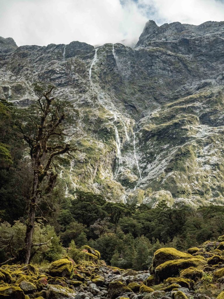
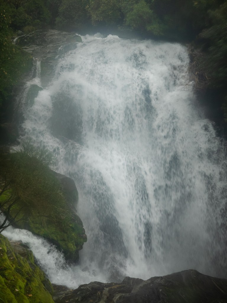
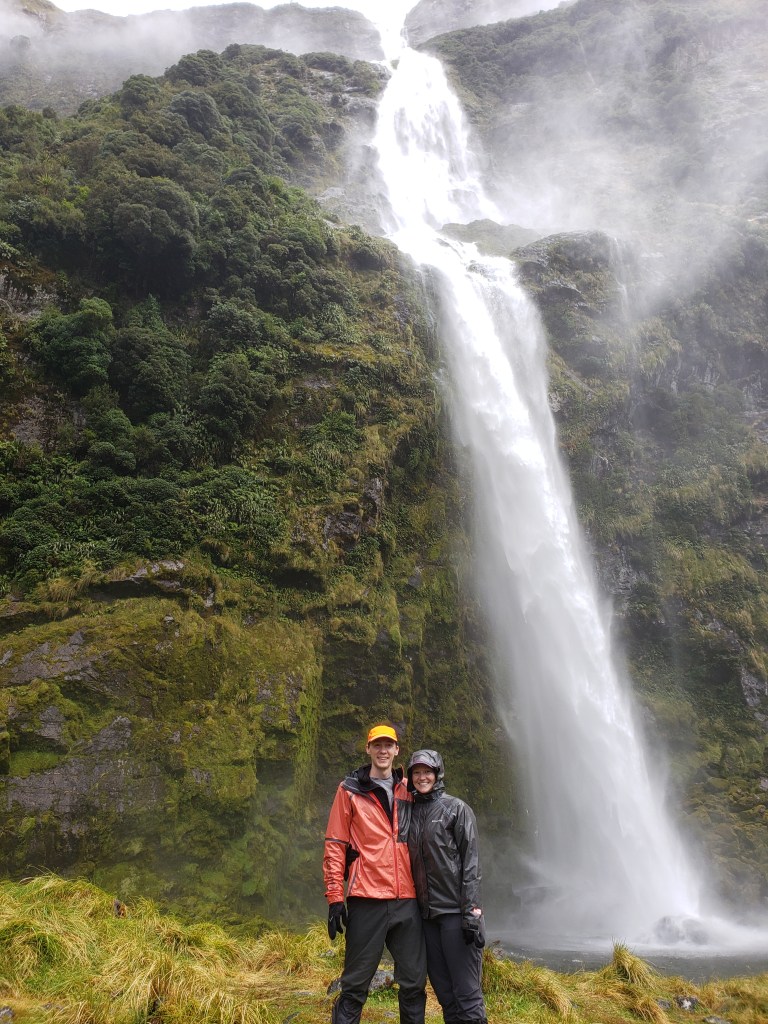
With all the rain, the steep rocky walls around us turned into cascading waterfalls everywhere! It was incredible, and made it absolutely worth the rain!


The weather actually cooperated quite nicely; though there were periodic rain showers, there were also bouts of sunshine to dry us out!
The meadows and fields soon became the norm, and the stretches of forest became welcome shelter from the sun or rain.

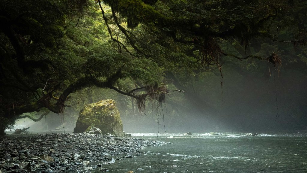
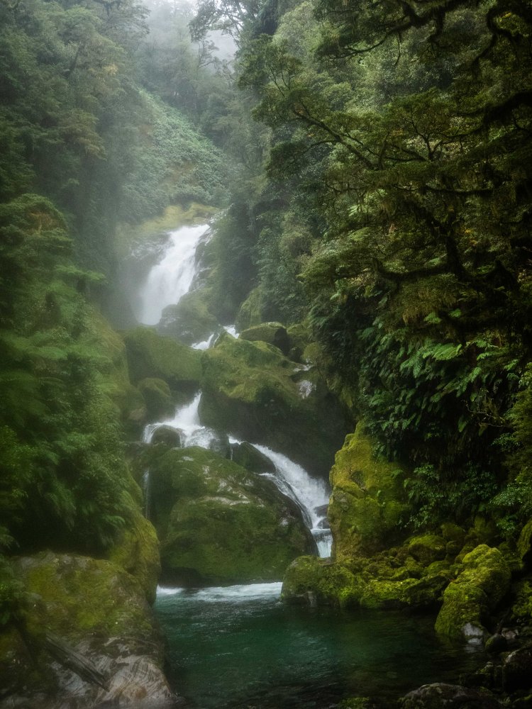
Kadi and I took a side stream detour back to the Clinton river, and found an incredibly magical scene. Cold air had settled in the protected river bend, forcing the moisture out of the air into a gentle mist.

The true splendor of the Milford Track comes from it’s varied terrain. One moment you’re walking through a deep, tangled forest; the next, at the foot of the mountains conversing with clouds.


Our lunch stop at a small shelter was two fold: lunch for ourselves, but also lunch for the swarm of sandflies that had congregated around us. They have much more patience than either Kadi or I, so our lunch was frustrating and brief. At least we could enjoy the view!

The day wore on, and our feet were starting to figure out that they were short-changed. The previous five days of hiking were starting to show, and we slowed our pace accordingly.


I took a few timelapses of the regal peaks around us as we stretched our arms and set down our packs. However, the late afternoon gales that Ross had warned of were starting to darken the skies, so we didn’t take too long to move on.


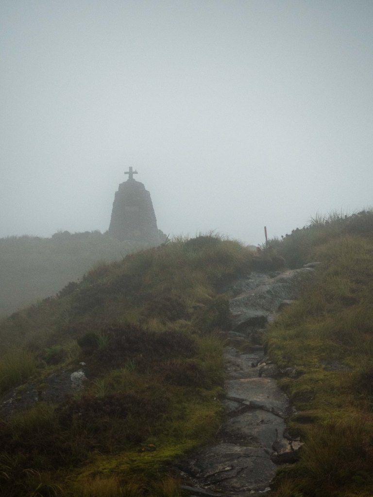
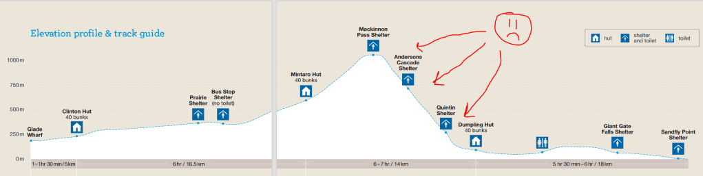
The second day of the Milford Track takes you to a hut just underneath Mackinnon Pass, a high, exposed saddle visible for miles. We could see it getting larger, so we thought we were close!

Unfortunately, where you think you are on an elevation profile rarely lines up with reality. Our feet and legs complained for the last 200m of gain as rain clouds tumbled over the pass towards us.


The second hut was finally in front of us, and we undertook the same ritual as the night before.
We found our friends Tom and Murray and chatted with them, but also caught up with a few other hikers about the sights of the day. The ranger at this hut wasn’t quite as scary, but this also meant she wasn’t as memorable.
The rain set in shortly after we had arrived, and stayed steady for the rest of the night.
The next morning, the radio-ed in weather report told us what we already knew: rain. We packed up our bags, pulled on our rain pants, and trudged out in our shoes wet from the day before. Fun!


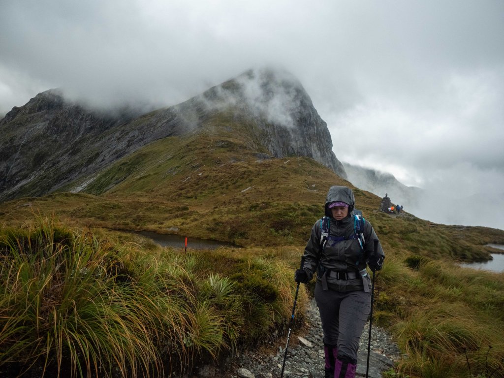
Today’s mission was simple: ascend Mackinnon Pass, then descend it. Easy in principle, but the river flowing down the trail certainly didn’t help.

Despite the rain, wet, wind, cold, fog, and aches, we knew what we had signed up for and were in pretty good spirits!

Mackinnon Pass was ours before long, and we were excited that the hard part of the day was already over!

While we were at the top, the cloud cover broke for just an instant, allowing us some stunning views of the valley we would be descending into!


There is a shelter just on the other side of the pass, and we had made ourselves a goal to make some hot chocolate there to warm up. We continued through the clouds to find our promised relief!

After a short walk, the shelter appeared out of the fog, and we joined a handful of our fellow trampers staying warm inside.
In the shelter, I talked to the other photographer I had met the day before, and found out that he had been waiting there since sunrise in hopes of getting a glimpse of the surrounding mountains. I felt a little bad when the clouds cleared for a few moments just after we got to the shelter, but he was just as excited as we were!

After taking a few (dozen) more photos, we started the descent down to the Milford Sound.

As we descended, the clouds let loose, and the rain came down in sheets.

Though my camera is weather sealed, I don’t think Panasonic had the Milford Track in mind when designing it that way, and my G9 soon started acting funny.
It didn’t happen all at once. It happened slowly, as the storm continued on our head. First, the faint blurriness, then a noticeable fog in every picture. As the rain worsened, photos became indiscernibly blurry. At last, attempting to take a picture of one final waterfall, the camera gave out and the screen stayed black.
As it turns out, the hardest part of the day would be the wet, rock-hopping descent from MacKinnon Pass, rather than the relatively mild ascent. The trail was the path of least resistance for the torrents coming down, and any dirt or gravel that would have made for a flat, smooth trail had been washed away decades ago. This left only the jagged, uneven rocks to find our way across.
After a couple hours the rain started to let up, and we found ourselves at the turnoff to see Sutherland Falls, the largest waterfall in New Zealand! Even though our feet and legs had had quite enough at that point, our vow to take every side path compelled us down the walkway.
Luckily, we had already reached the bottom of the valley, so the journey was largely lateral. We had left our packs in a shelter at the start of the side path, so the hour long walk was much more pleasant than the previous hours.
We could see the waterfall through gaps in the foliage, a white line snaking it’s way down the steep wall.
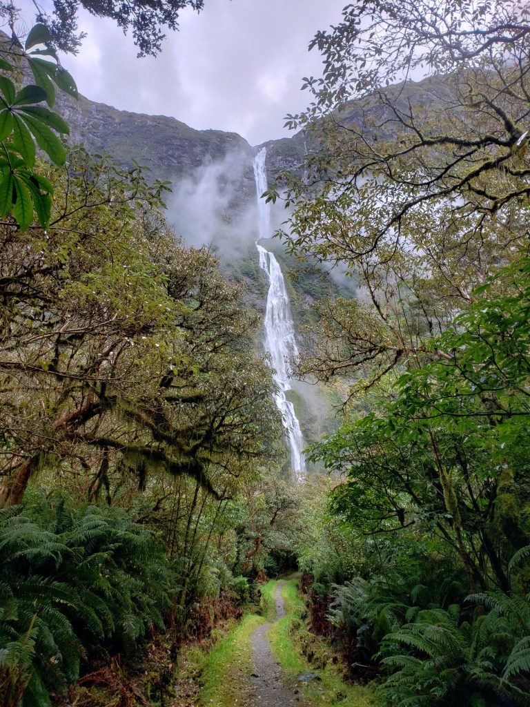
The base of the falls was an impressive display of force. The spray and wind created by the 1900 foot drop kept us well away from the true base as we talked with a few other trampers there. We soon returned back the way we came.
Once we got back to our packs, we saddled back up for the last hour of the day. The path was fairly flat and smooth, so we could hike without calculating every step. The last hut finally came into view, a complex of three buildings already decorated with boots, packs, and socks hanging to dry.
As with the Kepler track, the last night of this journey was a little bittersweet. We had taken the opportunity to meet almost all of the separate groups by now, and felt comfortable talking and joking around with them while dinner was rehydrating. Since Kadi and I are night owls (and because we got to the hut late), we were the last ones left in the kitchen building, all the other trampers having headed off to bed after a long day of hard walking.
We felt good! Our feet were sore and our legs were tired, but we had just been tramping long days for nearly 8 days straight. We were proud! Because my camera was still dead (it had taken one picture since it drowned, so that’s progress) and we were motivated, we decided that we were going to move up in the hiking chain–we had previously been at the end of the group, always last to the huts and hiking in the middle of the day.
Not tomorrow! We vowed to wake up early and leave as soon as we possibly could, and cruise down the trail as quickly as possible. The final day was the longest–18km– but also the flattest, and all downhill.

Walking in the cool morning mist was refreshing for our fatigued soles and souls, and we made great time! We started timing ourselves between the posted mile markers, trying to beat our previous mile each time!

We stopped at a couple cool features on the last day, but didn’t stay for long. We were on a mission!
Though we pride ourselves in our minimal amount of gear, there was one couple who put us to shame in terms of gear–they basically had day packs for the whole 4-day journey! Though they caught up to us at a couple of the stops, we did our best to stay ahead of them.


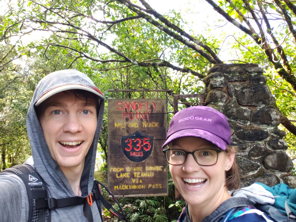
In the end, we were the second group to get to the final shelter at Sandfly Point! The next leg of the journey is a boat shuttle from there to the Milford Sound, and we were there early enough to get onto the first boat!
The sun shone and spirits were high as we crossed the sound into the small tourist village. We were all proud and tired, but a little sad that it was over.

Somehow I forgot to take a picture of the Milford Sound and Mitre Peak, so here’s one from last time we were here in 2017!

We waited around for the final bus to take us back to Te Anau, swapping phone numbers and email addresses with the strangers become friends.
Even though the bus ride back to Te Anau was incredibly scenic, almost all of us succumbed to weariness, and dozed off. I think that’s the sign of a successful adventure!
Someday I’ll be back to climb Mitre Peak. But until then, thanks for reading!
–Cameron

Very beautiful! Your narrative was informative …clear & concise and the photos were great…I loved the waterfalls too! Thanks for sharing the beauty of the experience.
LikeLiked by 1 person
If I could get your blog as an IV directly into my veins, that’d be great. Thank you so much for sharing your travels and beautiful photos. Unfortunately that isn’t a rock wren but where do I submit my guess for the mountains from Kepler? 🙂
LikeLiked by 1 person
We were told there were Rock Wrens around up there, but couldn’t get close enough/don’t know what we’re looking for haha. I guess you can DM me a screenshot on IG? (Cameron)
LikeLike
Thank you for sharing your adventures! I love that there are references to your previous NZ experiences. By the way, my favorite pictures are waterfall pictures. (I take more pictures of waterfalls than anything else (even people.)
LikeLike